Atlas
Atlas helps you explore biblical events by place. You can see where stories are connected, focus on the Old or New Testament, and open the related Scripture without searching for each reference yourself.
What Atlas does
Section titled “What Atlas does”Atlas places supported biblical locations on an interactive map. Each location can be connected to one or more stories and Scripture references.
You can view the locations in two ways:
- Heat shows areas of story activity as a colored glow. Brighter areas have more story links under the filter you are using.
- Pins shows individual place markers. Places with more story links use larger markers. When several places are close together, Atlas may combine them into a numbered circle until you zoom in.
Atlas is different from the map in Study Lens. Study Lens focuses on places connected to the chapter you are reading. Atlas lets you explore supported places and stories from across the Bible.
When you might use it
Section titled “When you might use it”- Find stories connected to Jerusalem, Bethlehem, Egypt, or another place.
- Compare Old Testament and New Testament activity in a region.
- See which locations have many linked biblical events.
- Preview the Scripture connected to a place.
- Move from a place-based overview into the Reader for closer study.
Where to find Atlas
Section titled “Where to find Atlas”- Open the main GospelGrasp menu.
- Tap Atlas.
Atlas opens as a full-screen map. The navigation controls at the top remain available for Scripture search, settings, your account, and sermon recording.
See it in GospelGrasp
Section titled “See it in GospelGrasp”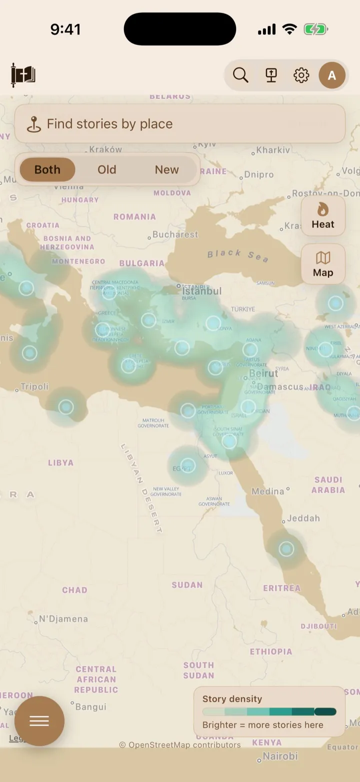
The Atlas can combine heat and place markers to show where Bible stories occur.
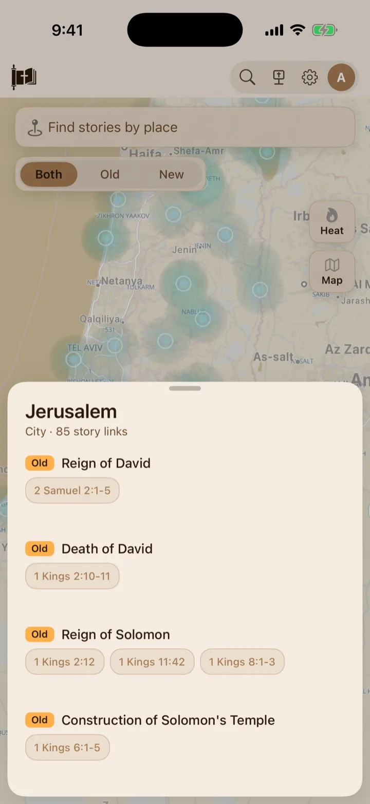
Open a place to browse the stories connected to it.
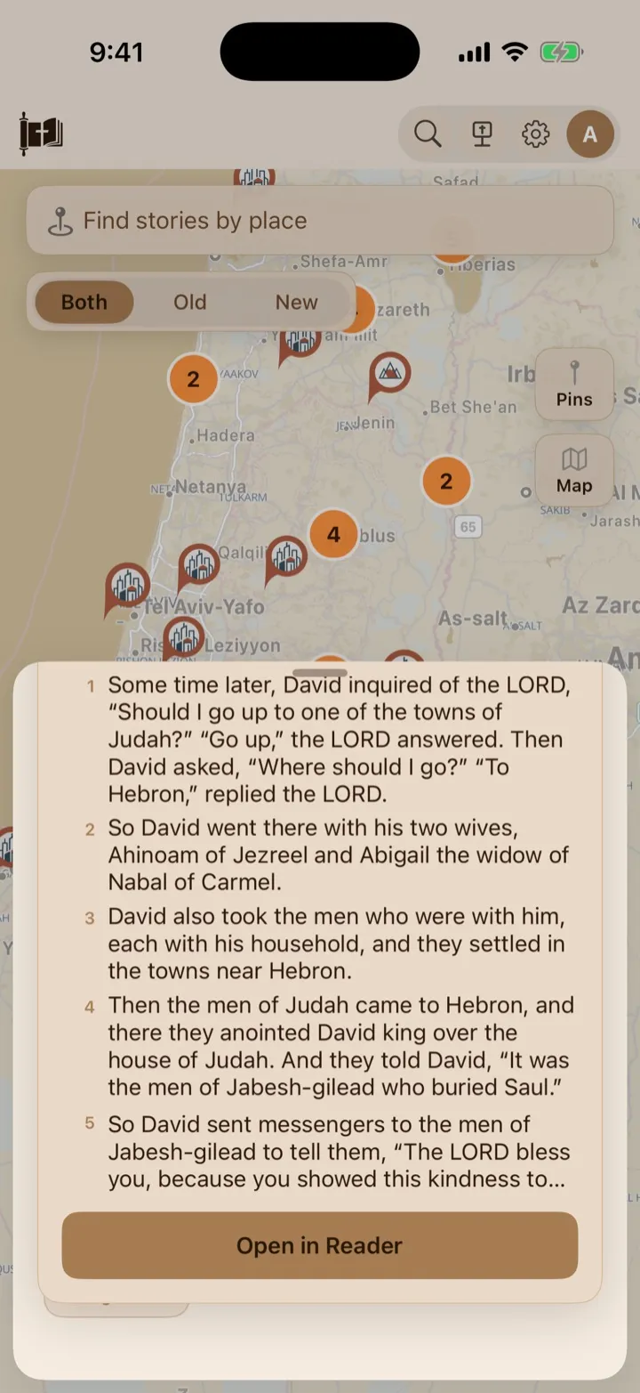
Tap a story reference to preview its Scripture, then open it in the Reader.
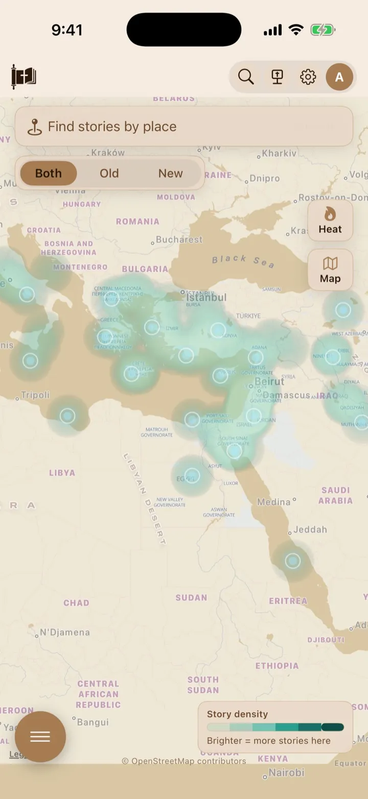
Heat view shades the map by story density.
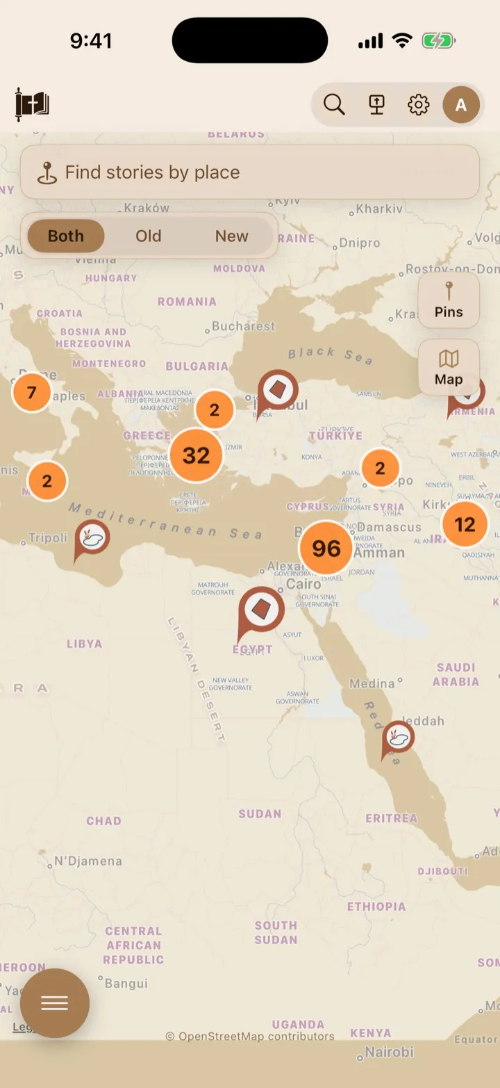
Pin view shows the same region as individual places and numbered clusters.
Move around the map
Section titled “Move around the map”- Drag the map to move to another area.
- Pinch with two fingers to zoom in or out.
- Tap a visible place marker or heat-map point to open that place.
- Tap Focus in an open place card to collapse the card, zoom closer, and keep the selected location centered in the uncovered part of the map. A crosshair marks the selected coordinate.
- In Pins view, tap a numbered group of places to zoom in and separate its markers.
When Atlas first opens, it adjusts the map to include all locations available under the current testament filter.
Choose which testament to explore
Section titled “Choose which testament to explore”Use the control beneath the place search field:
- Both shows supported stories from the entire Bible.
- Old shows places with at least one supported Old Testament story.
- New shows places with at least one supported New Testament story.
Changing this filter updates the visible places, heat intensity, story counts, search results, and stories in a place card. A location can disappear when it has no stories under the selected filter.
The Old and New Testament are the Bible’s two main collections of books. The Old Testament records the biblical story before Jesus’ earthly ministry. The New Testament begins with the Gospels and continues through the early church and its letters.
Switch between Heat and Pins
Section titled “Switch between Heat and Pins”Tap the Heat or Pins button on the right side of the map to switch views.
Heat view
Section titled “Heat view”Heat view emphasizes the concentration of linked stories rather than drawing a large marker for every place. The Story density key explains the color scale. Brighter color means more supported stories are connected to that area under the current filter.
The heat display changes as you move and zoom. It compares the places visible on the map, helping smaller regional concentrations remain noticeable when you zoom in.
Small points remain tappable within the colored areas. Tap one to open its place card.
Pins view
Section titled “Pins view”Pins view shows place markers instead of the story-density glow. Marker designs help distinguish cities, regions, mountains, bodies of water, and other types of places where that information is available.
The marker size reflects the number of linked stories under the current filter. At a wide zoom level, nearby markers may appear as one numbered circle. Tap the circle to zoom closer.
Switch between Map and Satellite
Section titled “Switch between Map and Satellite”Tap the Map or Sat button on the right side of the map:
- Map uses GospelGrasp’s simplified map style. Its colors follow your Light, Dark, Sepia, or Bedtime theme.
- Sat uses satellite imagery to show the modern landscape.
The simplified map is useful for following names and boundaries without as much visual detail. Satellite view can help you understand terrain, coastlines, and the relationship between land and water.
Search for a place
Section titled “Search for a place”Atlas has its own place search field labeled Find stories by place. This is separate from the Scripture search in the top navigation.
- Tap Find stories by place.
- Start typing a place name. Atlas can also match a supported alternate name.
- Review the matching places beneath the field.
- Tap a result to center the selected location in the visible map and open its place card.
Tapping the empty search field shows the available places alphabetically. You can scroll the results when more than six are available. Pressing Return opens the first current result.
Each result shows:
- the place name;
- its type, such as city or region;
- the number of story links under your current filter; and
- separate Old and New Testament story-link counts.
Changing Both, Old, or New while the search list is open updates the results and their current counts.
Open a place and browse its stories
Section titled “Open a place and browse its stories”Tap a map location or choose a place from search. A place card opens from the bottom of the screen.
The card shows the place name, its type or region where available, and the number of story links under the current testament filter. You can drag the card up for more room or drag it down when you are finished.
Tap Focus beside the place name when you want a closer map view. Atlas collapses the card, zooms to a scale suited to the selected place, and places a crosshair over its mapped coordinate. Larger regions, such as countries, remain wide enough to show their surrounding area.
Each supported story can include:
- an Old or New badge;
- the story or event title; and
- one or more Scripture-reference buttons.
References from the same chapter may be combined into a range, such as Genesis 13:1–5, instead of appearing as five separate buttons. If a story has several references, swipe the reference row sideways to see the others.
Preview Scripture and open the Reader
Section titled “Preview Scripture and open the Reader”- Open a place card.
- Tap a Scripture reference beneath a story.
- Read the verse or verse range in the preview card.
- Tap Open in Reader to leave Atlas and continue from that Scripture in the Reader.
The preview uses your selected Bible version when its text is available. GospelGrasp falls back to the Berean Standard Bible when the selected version does not contain that verse. If Semantic Scripture Colors are turned on, supported color cues can also appear in the preview.
For a reference range, Open in Reader opens the first verse in the range. You can continue through the remaining verses in the Reader.
Tap the close button on the preview card to return to the place’s story list.
What GospelGrasp saves or syncs
Section titled “What GospelGrasp saves or syncs”Atlas does not save or sync your search text, testament filter, map position, zoom level, or selected display mode. These are temporary choices for the current Atlas visit.
Opening a verse in the Reader works like other Reader navigation. Your normal reading position can update after you begin reading there.
Requirements and limits
Section titled “Requirements and limits”- Atlas links a story when its narrated event occurs at that place, or when the place is a meaningful journey origin, destination, or stop. A place mentioned only in conversation, ancestry, prophecy, comparison, or symbolism does not create a story link.
- Supported alternate names find the same location. For example, searching for Babel opens Babylon rather than creating a second map marker.
- Place information, story links, place search, and Scripture references come from a reviewed event-location collection included with GospelGrasp. The current collection has been checked for every source event with a mapped location, plus reviewed narrative gaps where the source named no location.
- The simplified map includes an offline overview. More detailed map tiles may need an internet connection when you zoom closer.
- Satellite imagery requires an internet connection unless the device already has the needed map imagery cached.
- Verse previews use Scripture stored by GospelGrasp and can remain available offline. Additional Semantic Scripture Color information may need a connection when it has not already been saved on the device.
- A marker represents a supported location on a modern map. It should not be treated as proof of an exact ancient boundary, route, or building location.
- Story-link counts describe the reviewed Atlas collection. They are not a claim that every possible way of dividing the Bible into stories, every disputed ancient location, or every scholarly interpretation is represented.
If something does not work
Section titled “If something does not work”A place does not appear
Section titled “A place does not appear”Check the Both, Old, and New filter. A place is hidden when it has no supported stories under the selected filter. You can also search for another known or alternate name.
If the place still does not appear, Atlas may not have a reviewed story that actually occurs there. A place mentioned only inside another location’s story does not receive that story.
Search shows no results
Section titled “Search shows no results”Clear some of the search text and try the main part of the place name. Confirm that the testament filter is not hiding the location you want.
The map loses detail when I zoom in
Section titled “The map loses detail when I zoom in”Detailed simplified-map tiles may need an internet connection. Confirm that the device is online, or zoom out to the included overview map.
Satellite imagery does not load
Section titled “Satellite imagery does not load”Satellite imagery comes from the device’s online map service. Check your connection and switch back to Map if it remains unavailable.
A story has no Scripture references
Section titled “A story has no Scripture references”Some place or story information may be partial. Try another story for the place. If a familiar story is missing its expected Scripture, report it through Support and include the place and story names.
A verse preview says its text is unavailable
Section titled “A verse preview says its text is unavailable”Tap Open in Reader to check the passage directly. If the same verse is also missing in the Reader, try the Berean Standard Bible or report the reference through Support.
Common questions
Section titled “Common questions”Does a brighter area mean the place is more important?
Section titled “Does a brighter area mean the place is more important?”No. Brightness shows how many supported story links are attached to locations in that area under your current filter. It does not measure spiritual or theological importance.
Why did the heat colors change when I zoomed in?
Section titled “Why did the heat colors change when I zoomed in?”Heat view compares the locations currently visible on the map. Recalculating the display as you zoom helps regional story concentrations remain visible.
Why are several places inside one numbered marker?
Section titled “Why are several places inside one numbered marker?”Pins view groups nearby places when the map is zoomed out. Tap the numbered marker to zoom in and separate them.
Is Atlas showing the ancient world exactly as it appeared?
Section titled “Is Atlas showing the ancient world exactly as it appeared?”No. Atlas places biblical stories on a modern map to help you understand their geographic relationships. Ancient borders, roads, shorelines, and exact site locations may differ or be uncertain.
Can I add my own pins or drawings to Atlas?
Section titled “Can I add my own pins or drawings to Atlas?”No. Personal pins and measurement drawings are available in the Map tab of Study Lens, not in the full Atlas.